The Ridgeline Trail connects you to a 16-mile hiking trail loop at Kings Mountain State Park and Kings Mountain National Military Park called Kings Mountain National Recreation Trail.
Future plans for Thread Trail will link the Kings Mountain Gateway Trail and downtown Kings Mountain to the parks via these trails.
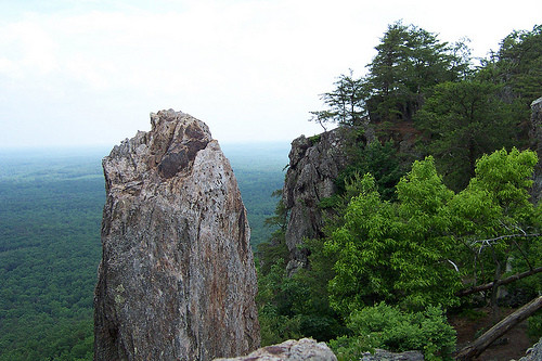
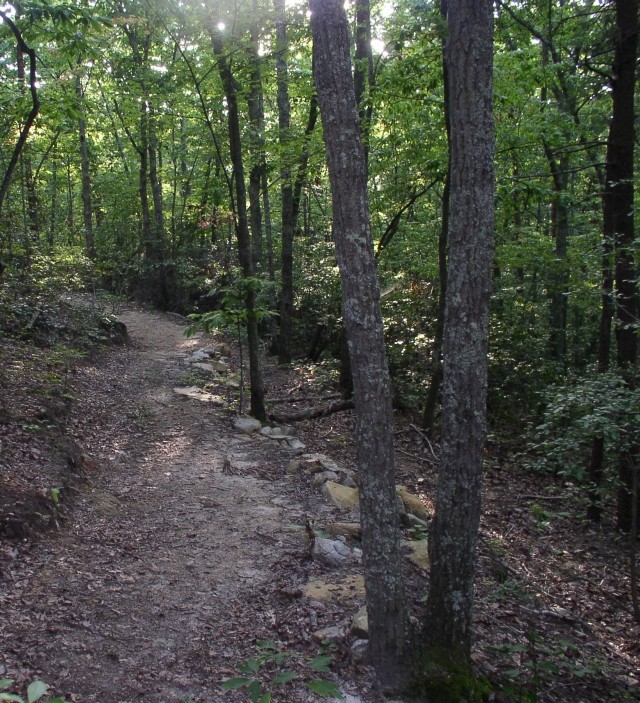
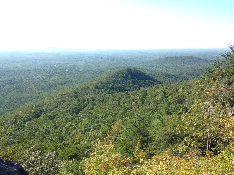
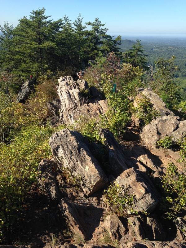
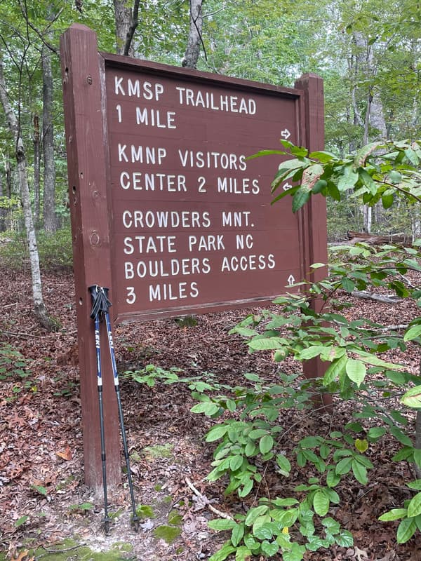
This trail includes everything from rocky aerie (Kings Pinnacle in North Carolina) to bottomland forest (almost immediately after crossing the state line into South Carolina). Starting from the Visitors Center at Crowders Mountain, the trail soon encounters a short spur up to 1,705-foot Kings Pinnacle. Rocky crags and stunted pines top this exposed ridge, offering nice views and scenery akin to the western part of the state. Back on the Ridgeline Trail you’ll enjoy sustained climbs and descents through Piedmont hardwood forest. This lovely ramble is interrupted three times by paved roads; pay close attention at each crossing. Shortly before crossing into South Carolina you’ll encounter Buzzard’s Roost at the Boulders Access Area. This area dedicated to bouldering — rock climbing without ropes — is testament to the rocky terrain you’ll encounter. That is, until you cross into South Carolina and the remaining trail is an easy passage through a more bottomland forest. Campgrounds can be found about a mile into the hike and at the end, at Kings Mountain, providing the opportunity to make this an overnight trip. - See more at: Great Outdoor Provision
Visit the Crowders Mountain State Park WEBSITE for information concerning additional trails, activities and rules.
522 Park Office Lane
Kings Mountain, NC 28086
Phone: (704) 853-5375
1277 Park Road
Blacksburg, SC 29702
Phone: (803) 222-3209
Crowders Mountain State Park Access from the Linwood Access at Pinnacle Trail:
Parking Address: Visitors Center - 522 Park Office Lane, Kings Mountain, NC 28086. MAP
Trailhead Location: MAP
- Take the 2 mile (one way) Pinnacle Trail from the Visitors Center. Take a left just before you reach the top of the Pinnacle Trail. There will be signage marking the start of the Ridgeline Trail
Crowders Mountain State Park Boulder Access:
Parking Address: 108 Van Dyke Road, Kings Mountain, NC 28086. MAP.
- Visitors can access the Ridgeline Trail from this parking area, which will put visitors 6.2 miles further along the trail from the Pinnacle Trail access point.
Kings Mountain State Park Access:
Parking Address: GPS Address - 1277 Park Road, Clover, SC 29702. MAP.
- Take the National Rec Trail for 0.5 miles towards the Ridgeline Trail. Stay to your right.
Success! A new password has been emailed to you.