First Broad River TrailFirst Broad River Trail is currently closed to the public for trail maintenance. Please check back and enjoy the improved trail once work is done.

Little Sugar Creek Greenway: Polk State Historic Site to SC Line

This segment of Little Sugar Creek Greenway is 2.5 miles one-way, from the James Polk Historic Site to the SC state line, where it connects to a subdivision's street network. Of moderate difficulty due to a few long gradual inclines, the curving route includes numerous benches and views of the creek and wildlife. (There is no public parking at the southern terminus of the trail in the Prestwick development.)
Trail Uses
Accessible Experience Walking / hiking / running Paved surface biking
Length
2.50 miles, One Way
Difficulty
Moderate
Surface
Boardwalk, Pavement
Motorized Vehicles
Not Permitted
Fees
No
Pets
Permitted on leash
Parking Spaces
45
Restrooms
No

Description

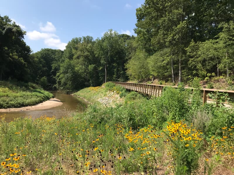
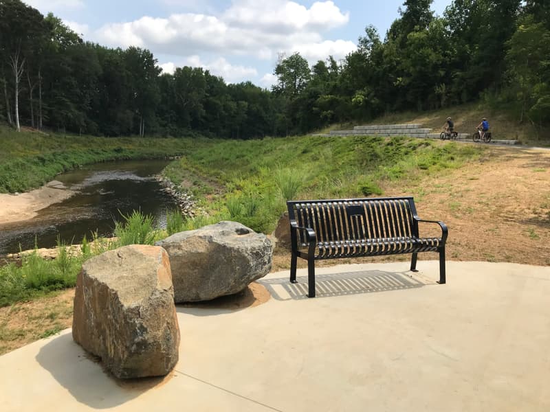
This curvilinear section of Little Sugar Creek Greenway is approximately 2.5 miles in length and provides numerous rest points and overlooks of the riffles in the creek. The 12-ft wide greenway is mostly asphalt but also includes concrete decking on the boardwalks and bridges. The route is bordered by grass shoulders, wooded areas, and wildflowers, as well as the creek itself. Trail users may spot deer in the woods or geese in the creek. Several access trails provide connectivity to surrounding street networks. (Note: There is no public parking at the SC state line in the Prestwick development. See trailhead information for parking.)

Other Information

Greenways in Mecklenburg County operate 24/7, as they are transportation components of a larger network. The trail is 12 feet wide and paved. All access complies with ADA Recreational Trails. Wayfinding on the site specifies the rules and regulations. Mile markers are part of the signage. There is no lighting on the trail.

Featured Post

Our Top 10 Adventures on the Thread Trail
Summer is a great time to get outside, whether that’s paddling on the water, hiking a trail or cruising on a greenway.
> Read Post

Trail Tips

Layer Up
When out on trail in cooler weather, wear layers which are easy to add/remove so that you can maintain a comfortable temperature.

Trailhead Information

Parking locations:

12031 Lancaster Highway, Pineville, NC 28134 (James K Polk Historic Site), MAP

      Trailhead location: MAP

387 Lake Dr, Pineville, NC 28134, MAP

Trailhead location: MAP

Click on an icon to get custom directions
Please Log In or Create Account to add comments.
January 24, 2024
Hi Brian! While there is parking space at the SC terminus it is for the neighborhood only, not public parking. The closest public parking access is at 387 Lake Dr, Pineville, NC 28134.
biscuiteater40
January 21, 2024
It seems the SC terminus does have public parking lot, for about five cars.
Hang Tight!
Nearby services are loading
SHARE THIS TRAIL
PRINT THIS TRAIL

Add Trail Log

Please wait…
Join In on the Fun!
Log in or create an account below to unlock all the great features of Carolina Thread Trails: keep track of trails you want to do, preserve memories of trails you’ve done, and more!
Your log in attempt was not successful. Please try again.
    Lost your password? Reset your password
    Don't yet have an account?
    There was an issue with your submission. Please try again.
      * Indicates required field
      Already have an account? Login here
      Enter your username, and we will send you a new, randomly generated password to your email account.
      There was an issue with your submission. Please try again.

        Success! A new password has been emailed to you.

        Log in now

        Please wait…